Uncategorized
Chesapeake Bay Dead Zone
The Chesapeake Bay Program summarized the results of a study on nutrient loading in the Chesapeake Bay on their site last week. The study, by Yuntao Zhou, Donald Scavia, and Anna M. Michalak, found that the Chesapeake Bay’s annual dead zone’s size and severity has remained unchanged in recent years, the duration of the dead zone, however, has declined over time. The report in Limnology and Oceanography also examines the role of meteorological factors in the development of dead zones.
Declining Planting Rate for Forested Riparian Buffers
Link Posted on
Declining Planting Rate for Forested Riparian Buffers
After posting yesterday about tree cover in the Chesapeake region, I came across this article from the Bay Journal on riparian forested buffer zones. According to author Karl Blankenship, streamside tree planting rates are falling. Forested buffers improve stream health, and help states in the Chesapeake watershed reach Bay cleanup goals. The six states, and the District of Columbia, which make up the Chesapeake Bay watershed, have pledged to plant 15,000 miles of forested buffers by 2025; yet last year only 202 miles were planted. Blankenship outlines the implications of this declining rate of planting, and looks at what needs to be done to turn the trend around.
Forest Watch in Chesapeake Region
The World Resources Institute’s Global Forest Watch runs a mapping application that monitors forest cover across the globe. I have been looking at the Chesapeake Bay region and using the different tools to examine tree cover in the region, and loss and gain of tree cover from 2000-2013.
I expected there to be more loss of tree cover, believing there to be a rise in development around the Chesapeake Bay over the last decade. The data comes from the University of Maryland, which defines tree cover loss as “the complete removal of tree cover canopy at the Landsat pixel scale.” The application looks at major changes, such as the loss of tree cover though disease, fire, or timber harvesting. I’m not sure, but the map may not be picking up on smaller scale activities, such as home building.
Overall there seems to be a lot of simultaneous gain and loss, on the Virginia side of the Chesapeake, and more gain over the last thirteen years on Maryland’s Eastern Shore.
If a user wants to look at a specific area more closely, he or she can examine forest use and conservation. Users are also able to submit their own stories and data to document change in a particular region. I’ve posted the link below:
Global Forest Watch
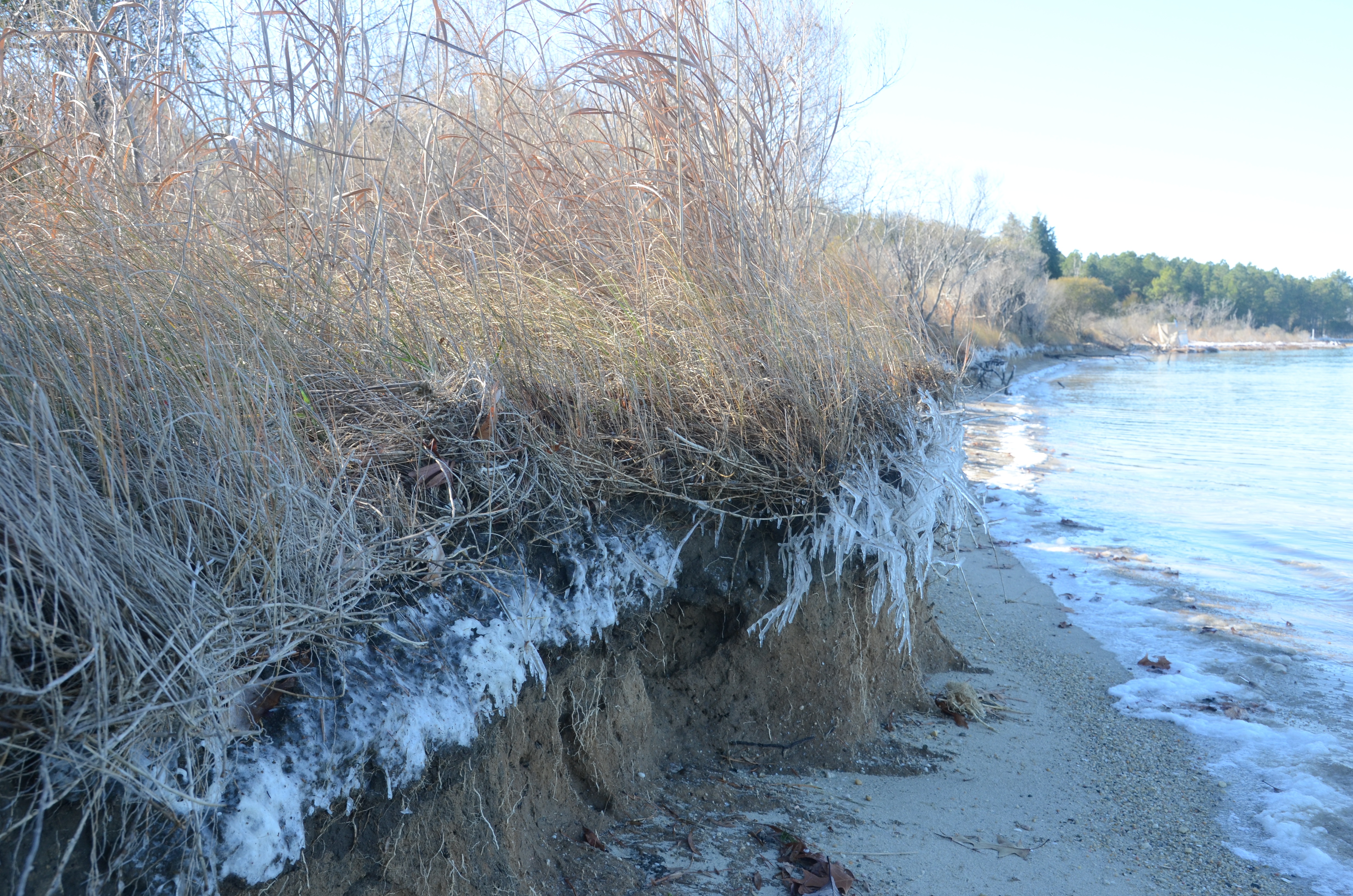
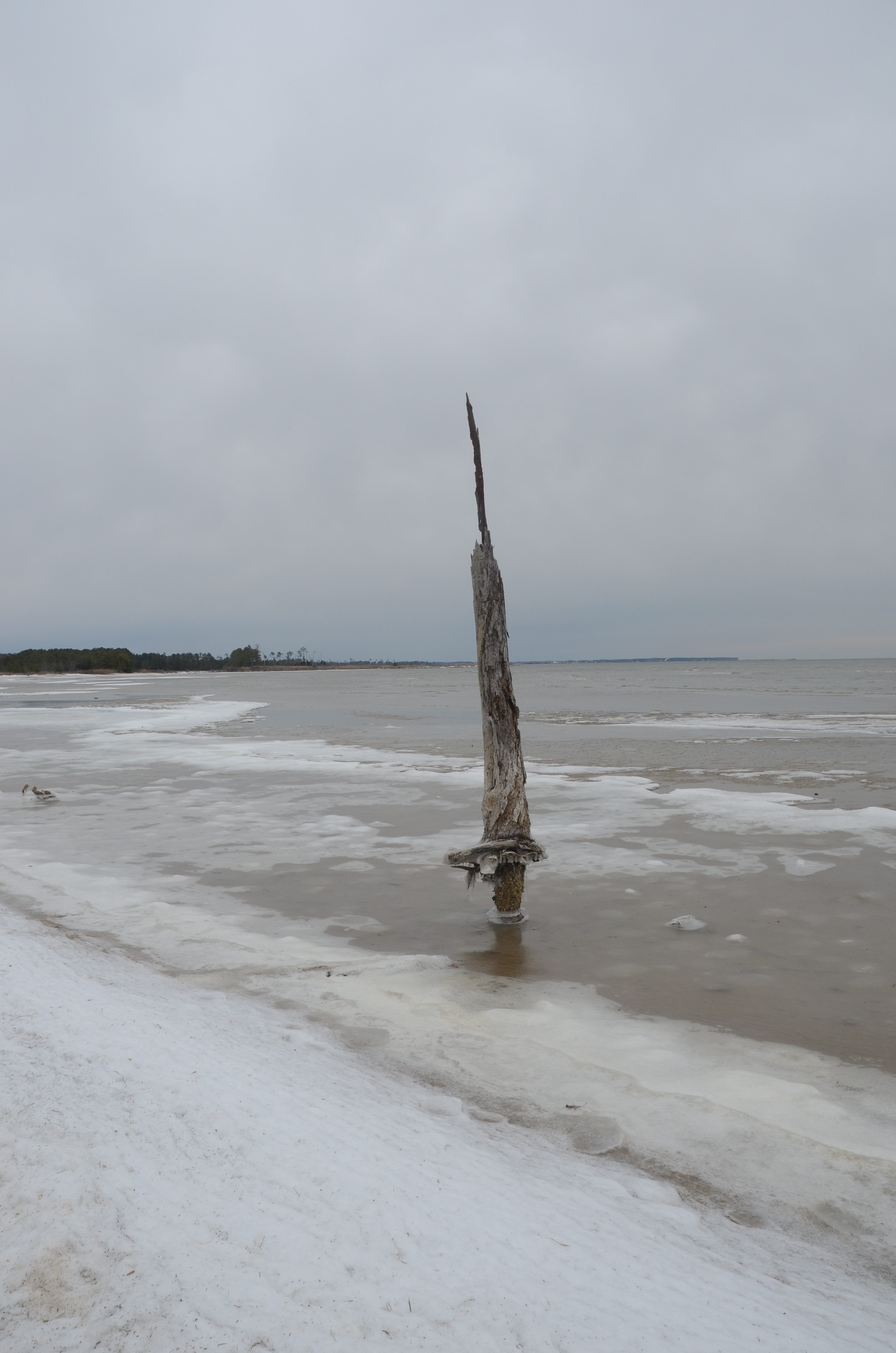
The State of Virginia’s Wetlands
A look at how sea level rise is affecting two Virginia marshes, Dameron Marsh and Hughlett Point, and what this means for the future of wetlands in Virginia’s Chesapeake Bay region:
Additional photos from Dameron Marsh
and Hughlett Point
Chesapeake Bay Program Report on Water Quality Improvements
Link Posted on
Chesapeake Bay Program Report on Water Quality Improvements
The Chesapeake Bay Program recently released a report on the improvement of water quality in the Chesapeake. Using evidence from 40 different case studies on the watershed, the report examines how best management practices (BMPs) have reduced sediment loads and atmospheric nitrogen deposition. Specifically, an improvement in methods used in agriculture, at wastewater treatment plants, and better control of power plant and vehicle emissions have positively impacted the Bay.
The report also details current challenges associated with implementing BMPs (with a focus on population growth and intensive agriculture in the region), while looking at further opportunities for water quality improvement.
Chesapeake Stormwater Network’s Homeowner Guide
This afternoon I’ve been reading about the Chesapeake Stormwater Network and looking over their Homeowner Guide for a More Bay-Friendly Property. The guide goes into projects and practices such as rain gardens, rain barrels, planting trees, rain permeable driveways and conservation landscaping.
Reading for some starter tips on potential spring projects:
Friday News Roundup
Virginia’s Northern Neck Soil and Water Conservation District briefed on consequences of hydraulic fracking, proposed in the region: (Rappahannock Record).
Secretary of Natural Resources for the Chesapeake Bay Appointed in Virginia: (Bay Journal)
Rally at Cove Point, Maryland to protest export of natural gas: (Baltimore Sun)
Pennsylvania’s Department of Environmental Protection hears responses to Chesapeake Bay Watershed Agreement: (PA Environment Digest)
Tunnel Under D.C. Will Reduce Flow of Sewage into Local Waters
Link Posted on Updated on
Tunnel Under D.C. Will Reduce Flow of Sewage into Local Waters
The Washington Post covered a story in Sunday’s paper on a solution to sewage overflow into local rivers. Workers are constructing a tunnel under Washington D.C., using a machine, “The Lady Bird,” to take up the soil. The end product will be a 13 mile long sewer tunnel, to prevent the flow of untreated sewage to the Potomac and Anacostia River, and to Rock Creek, which frequently occurs with the overburdened combined sewer system in the District.
This tunnel could do a lot to clean up the local rivers, and reduce the flow of polluted water into the Chesapeake Bay. The Post states that all the soil collected by the Lady Bird will be transported to a dumping site in Maryland. My question however, is what happens to all this excess soil? Is there risk of the soil reentering the watershed through runoff, and how much of a risk could this pose?
In the News
Anti-sprawl efforts in Maryland help curb nutrient runoff to Chesapeake by limiting the spread of developments with septic systems; Charles County farmers find fault with limitations (Washington Post).
Maryland Director of Natural Resources Secretary’s confirmation held up (Baltimore Sun).
PA Governor Corbett encouraged to include clean water investments in budget plan that will target stormwater runoff (Public News Service).
Chesapeake Bay cleanup threatened by agricultural lobbyist groups, attorneys general from states outside of Bay watershed over fears that EPA rulings in Bay cleanup efforts could be applied to the Mississippi River Basin and beyond (Washington Post).
The Chesapeake Bay Foundation responded to efforts to derail the Bay clean up (see above link) in a press statement released Tuesday. (CBF Press Statement).
Update on Grasses Restoration Project
I’m working on two projects dealing with the restoration of underwater grasses in the Chesapeake Bay. The first is the Grasses for the Masses program though the Chesapeake Bay Foundation. I planted celery seeds almost two weeks ago and several small shoots have emerged. I’ll continue growing the grasses until it’s time for planting in May.

The second project involves planting grasses in Antipoison Creek, just off of the Chesapeake Bay. I’ve been talking with the National Resources Conservation Service (NRCS) and the Virginia Institute of Marine Science (VIMS) to get this project going. In order to plant grasses I’ll need to get a permit from the NRCS, but research and planning is required before starting the permit process.
I’ve been talking to an expert at VIMS to fully understand the process and methods involved with growing underwater grasses, and figuring out what species of grass to use.
I’m planting celery seeds in Northern Virginia, but when mature, these grasses will be planted on the Potomac River in a region that has lower salinity levels than Antipoison Creek. I’ll work with a species adapted to saltier waters, such as eelgrass or widgeon grass for Antipoison Creek.
Additional questions I have been researching include when to plant, how to plant, where to get seeds or grasses, water depth needed for these plants to survive, and other materials that might be needed for the process. I’m still working on some of these answers, but here’s what I’ve learned so far:
- Eelgrass requires a water depth of about 0.5 to 1.0 meters at mean low water and a tidal range of 80-100 centimeters. This allowed me to determine where to plant off of the shore.
- There are two main methods for growing underwater grasses: planting seeds and transplanting shoots of grass, each has various sub-methods
- The optimal planting time for transplants is late September to early October
- To plant seeds, seeds must be collected from their source in mid-May to early June; planting experiments must be conducted mid-August to mid-October.
I’m still deciding whether to transplant grass shoots or plant seeds, and which specific method to use. I can broadcast seeds by hands, plant seeds via buried burlap bag, transplant bundles of shoots, or transplant single unanchored shoots. Part of this decision will involve figuring out where to get the seeds or grass shoots for planting. I’ll be updating the blog as I learn more.
